GIS for Animal Health: Perbedaan revisi
| Baris 1: | Baris 1: | ||
== Using QGIS in Animal Health == | == Using QGIS in Animal Health == | ||
| − | [[Image:QGIS_2.svg| | + | [[Image:QGIS_2.svg|250px|frameless|left]] |
| − | + | [[GIS:Bahasa Indonesia|Versi Bahasa Indonesia]] | |
| + | |||
| + | [[GIS:English|English Version]] | ||
=== Why use QGIS? === | === Why use QGIS? === | ||
Revisi per 20 Juli 2014 11.36
Daftar isi
- 1 Using QGIS in Animal Health
- 2 1 Pengenalan
- 3 2 Modul : Antarmuka
- 4 3 Modul : Membuat Peta Sederhana
- 5 4 Modul: Mengklasifikasi Data Vektor
- 6 5 Modul: Membuat Peta
- 7 6 Modul: Membuat Data Vektor
- 8 7 Modul: Analisis Vektor
- 9 8 Modul: Raster
- 10 9 Modul: Melengkapi Analisis
- 11 10 Modul: Plugin
- 12 11 Modul: Sumber Data Online
- 13 12 Modul : Grass
- 14 13 Modul: Penilaian
- 15 14 Modul: PostgreSQL
- 16 15 Modul: PostGIS
- 17 16 Module: Using QGIS in animal health
- 18 17 Lampiran: Berkontribusi Untuk Manual ini
- 19 18 Lembar Jawaban
- 20 1 Introduction
- 21 2 Module : The Interface
- 22 3 Module : Creating a basic map
- 23 4 Module: Classifying vector data
- 24 5 Module: Creating maps
- 25 6 Module: Creating vector data
- 26 7 Module: Vector analysis
- 27 8 Module: Rasters
- 28 9 Module: Completing the analysis
- 29 10 Module: Plugins
- 30 11 Module: Online resources
- 31 12 Module : GRASS
- 32 13 Module: Assessment
- 33 14 Module: PostgreSQL
- 34 15 Module: PostGIS
- 35 16 Module: Using QGIS in animal health
- 36 17 Lampiran: Contributing to this manual
- 37 18 Answer sheet
- 38 Additional links to other QGIS tutorials and materials
Using QGIS in Animal Health
Why use QGIS?
As information becomes increasingly connected to geographical location, there is no shortage of tools able to fulfill some or all commonly used GIS functions. Why should anyone be using QGIS over some other GIS software package?
Here are only some of the reasons:
- It’s free, as in lunch. Installing and using the QGIS program costs you a grand total of zero money. No initial fee, no recurring fee, nothing.
- It’s free, as in liberty. If you need extra functionality in QGIS, you can do more than just hope it will be included in the next release. You can sponsor the development of a feature, or add it yourself if you are familiar with programming.
- It’s constantly developing. Because anyone can add new features and improve on existing ones, QGIS never stagnates. The development of a new tool can happen as quickly as you need it to.
- Extensive help and documentation is available. If you’re stuck with anything, you can turn to the extensive documentation, your fellow QGIS users, or even the developers.
- Cross-platform. QGIS can be installed on MacOS, Windows and Linux.
Click here if you would like a Gentle Introduction in GIS before commencing this training course. At the moment this introduction is available in English only.
Tiered course objectives
This course caters to different user experience levels. Depending on which category you consider yourself to be in, you can expect a different set of course outcomes. Each category contains information that is essential for the next one, so it’s important to do all exercises that are at or below your level of experience.
Basic
In this category, the course assumes that you have little or no prior experience with theoretical GIS knowledge or the operation of a GIS program. Limited theoretical background will be provided to explain the purpose of an action you will be performing in the program, but the emphasis is on learning by doing. When you complete the course, you will have a better concept of the possibilities of GIS, and how to harness their power via QGIS.
Intermediate
In this category, it is assumed that you have working knowledge and experience of the everyday uses of GIS. Following the instructions for the beginner level will provide you with familiar ground, as well as to make you aware of the cases where QGIS does things slightly differently from other software you may be used to. You will also learn how to use analysis functions in QGIS. When you complete the course, you should be comfortable with using QGIS for all of the functions you usually need from a GIS for everyday use.
Advanced
In this category, the assumption is that you are experienced with GIS, have knowledge of and experience with spatial databases, using data on a remote server, perhaps writing scripts for analysis purposes, etc. Following the instructions for the other two levels will familiarize you with the approach that the QGIS interface follows, and will ensure that you know how to access the basic functions that you need. You will also be shown how to make use of QGIS’ plugin system, database access system, and so on. When you complete the course, you should be well--acquainted with the everyday operation of QGIS, as well as its more advanced functions.
Versi Bahasa Indonesia
1 Pengenalan
This introduction includes introductory information about QGIS and how it was developed.
2 Modul : Antarmuka
This part of the course will introduce you to some of the basic concepts involved in working with GIS, the QGIS interface and will guide you in creating your first QGIS map.
3 Modul : Membuat Peta Sederhana
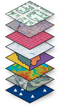
In this module you will crate a basic map which will be used later as a basis for further demonstrations of QGIS functionality. Included are lessons in using vector data, the most common kind of data used in GIS, and symbology, the way data is represented in a map.
4 Modul: Mengklasifikasi Data Vektor
Changing symbols for whole layers is useful, but the information contained within each layer is not yet available to someone reading these maps. What are the streets called? Which administrative regions do certain areas belong to? What are the relative surface areas of the farms? All of this information is still hidden. This module will explain how to represent this data on your map. Classifying vector data allows you to assign different symbols to features (different objects in the same layer), depending on their attributes. This allows someone who uses the map to easily see the attributes of various features.
5 Modul: Membuat Peta
Now we have a nice-looking map, but how are we going to get it out of QGIS and into a format we can print out, or make into an image or PDF? That’s the topic of this lesson! In this module, you’ll learn how to use the QGIS Map Composer to produce quality maps with all the requisite map components.
The first four modules will have taught you how to create and style a vector map. In the next four modules, you will learn how to use QGIS for a complete GIS analysis. This will include creating and editing vector data; analyzing vector data; using and analyzing raster data; and using GIS to solve a problem from start to finish, using both raster and vector data sources.
6 Modul: Membuat Data Vektor
Creating maps using existing data is just the beginning. In this module, you’ll learn how to modify existing vector data and create new datasets entirely.
For the next three modules, we’ll endeavour to answer a research question using GIS functions.
7 Modul: Analisis Vektor
This module includes lessons on reprojecting and transforming vector data, vector analysis tools, network analysis and spatial statistics. It discusses Coordinate Reference Systems (CRSs) and the use of different projections are discussed in more detail. By choosing the correct projection, you can ensure that the features on your map are being represented accurately. You will also be shown how to calculate distances between two points by activating a few useful tools. Spatial statistics allow you to analyze and understand what is going on in a given vector dataset. QGIS includes several standard tools for statistical analysis which prove useful.
8 Modul: Raster
Raster data is quite different from vector data. Vector data has discrete features constructed out of vertices, and perhaps connected with lines and/or areas. Raster data, however, is like any image. Although it may portray various properties of objects in the real world, these objects don’t exist as separate objects; rather, they are represented using pixels of various different color values. During this module you’re going to use raster data to supplement your existing GIS analysis. As well as working with raster data, this module includes lessons on changing the symbology for a raster layer and the use of terrain analysis tools.
9 Modul: Melengkapi Analisis
Now you have two analyses: the vector analysis which shows you the potentially suitable farms, and the raster analysis that shows you the potentially suitable terrain. How can these be combined to arrive at a final result for this problem? That’s the topic for this module. You will conclude the analysis and present the final results. This modules includes lessons in converting raster to vector data and combining analyses, as well as a supplementary exercise.
10 Modul: Plugin
Plugins allow you to extend the functionality QGIS offers. In this module, you’ll be shown how to manage, activate and use plugins.
11 Modul: Sumber Data Online
In this module we’ll look at how to use layers that are hosted on remote servers in real time. When considering data sources for a map, there is no need to be restricted by data you need to download onto the computer you’re working on. There are online data sources that you can load data from as long as you are connected to the Internet. In this module, we’ll cover two kinds of web-based GIS services: Web Mapping Services (WMS) and Web Feature Services (WFS).
12 Modul : Grass
Next, you’ll see how to use QGIS as a frontend for the famous GRASS GIS. GRASS (Geographic Resources Analysis Support System) is a well-known open source GIS with a wide array of useful GIS functions. It was first released in 1984, and has seen much improvement and additional functionality since then. QGIS allows you to make use of GRASS’ powerful GIS tools directly.
13 Modul: Penilaian
You will use your own data to create final map of your own. You will need: a point vector dataset of points of interest, with point names and multiple categories; a line vector dataset of roads; a polygon vector dataset of land use (using property boundaries); a visual-spectrum image (such as an aerial photograph); a DEM (downloadable if you don’t have your own).
14 Modul: PostgreSQL
PostgreSQL is a Database Management System (DBMS). In this module, you’ll be shown how to use PostgreSQL to create a new database, as well as accessing other typical DBMS functions. This module will introduce you to fundamental database concepts, help you to create a new database, implement a data model and add data to the model.
15 Modul: PostGIS
PostGIS is an extension to PostgreSQL which allows it to handle and process geographic data. In this module, we’ll learn how to set up and use the geographic functions that PostGIS offers.
16 Module: Using QGIS in animal health
The purpose of this module is to show how QGIS can be used to assist in animal health scenarios using data from iSIKHNAS.
17 Lampiran: Berkontribusi Untuk Manual ini
This is a little bit of information about how to contribute to QGiS and this manual.
English version
1 Introduction
This introduction includes introductory information about QGIS and how it was developed.
2 Module : The Interface
This part of the course will introduce you to some of the basic concepts involved in working with GIS, the QGIS interface and will guide you in creating your first QGIS map.
3 Module : Creating a basic map
In this module you will crate a basic map which will be used later as a basis for further demonstrations of QGIS functionality. Included are lessons in using vector data, the most common kind of data used in GIS, and symbology, the way data is represented in a map.
4 Module: Classifying vector data
Changing symbols for whole layers is useful, but the information contained within each layer is not yet available to someone reading these maps. What are the streets called? Which administrative regions do certain areas belong to? What are the relative surface areas of the farms? All of this information is still hidden. This module will explain how to represent this data on your map. Classifying vector data allows you to assign different symbols to features (different objects in the same layer), depending on their attributes. This allows someone who uses the map to easily see the attributes of various features.
5 Module: Creating maps
Now we have a nice-looking map, but how are we going to get it out of QGIS and into a format we can print out, or make into an image or PDF? That’s the topic of this lesson! In this module, you’ll learn how to use the QGIS Map Composer to produce quality maps with all the requisite map components.
The first four modules will have taught you how to create and style a vector map. In the next four modules, you will learn how to use QGIS for a complete GIS analysis. This will include creating and editing vector data; analyzing vector data; using and analyzing raster data; and using GIS to solve a problem from start to finish, using both raster and vector data sources.
6 Module: Creating vector data
Creating maps using existing data is just the beginning. In this module, you’ll learn how to modify existing vector data and create new datasets entirely.
For the next three modules, we’ll endeavour to answer a research question using GIS functions.
7 Module: Vector analysis
This module includes lessons on reprojecting and transforming vector data, vector analysis tools, network analysis and spatial statistics. It discusses Coordinate Reference Systems (CRSs) and the use of different projections are discussed in more detail. By choosing the correct projection, you can ensure that the features on your map are being represented accurately. You will also be shown how to calculate distances between two points by activating a few useful tools. Spatial statistics allow you to analyze and understand what is going on in a given vector dataset. QGIS includes several standard tools for statistical analysis which prove useful.
8 Module: Rasters
Raster data is quite different from vector data. Vector data has discrete features constructed out of vertices, and perhaps connected with lines and/or areas. Raster data, however, is like any image. Although it may portray various properties of objects in the real world, these objects don’t exist as separate objects; rather, they are represented using pixels of various different color values. During this module you’re going to use raster data to supplement your existing GIS analysis. As well as working with raster data, this module includes lessons on changing the symbology for a raster layer and the use of terrain analysis tools.
9 Module: Completing the analysis
Now you have two analyses: the vector analysis which shows you the potentially suitable farms, and the raster analysis that shows you the potentially suitable terrain. How can these be combined to arrive at a final result for this problem? That’s the topic for this module. You will conclude the analysis and present the final results. This modules includes lessons in converting raster to vector data and combining analyses, as well as a supplementary exercise.
10 Module: Plugins
Plugins allow you to extend the functionality QGIS offers. In this module, you’ll be shown how to manage, activate and use plugins.
11 Module: Online resources
In this module we’ll look at how to use layers that are hosted on remote servers in real time. When considering data sources for a map, there is no need to be restricted by data you need to download onto the computer you’re working on. There are online data sources that you can load data from as long as you are connected to the Internet. In this module, we’ll cover two kinds of web-based GIS services: Web Mapping Services (WMS) and Web Feature Services (WFS).
12 Module : GRASS
Next, you’ll see how to use QGIS as a frontend for the famous GRASS GIS. GRASS (Geographic Resources Analysis Support System) is a well-known open source GIS with a wide array of useful GIS functions. It was first released in 1984, and has seen much improvement and additional functionality since then. QGIS allows you to make use of GRASS’ powerful GIS tools directly.
13 Module: Assessment
You will use your own data to create final map of your own. You will need: a point vector dataset of points of interest, with point names and multiple categories; a line vector dataset of roads; a polygon vector dataset of land use (using property boundaries); a visual-spectrum image (such as an aerial photograph); a DEM (downloadable if you don’t have your own).
14 Module: PostgreSQL
PostgreSQL is a Database Management System (DBMS). In this module, you’ll be shown how to use PostgreSQL to create a new database, as well as accessing other typical DBMS functions. This module will introduce you to fundamental database concepts, help you to create a new database, implement a data model and add data to the model.
15 Module: PostGIS
PostGIS is an extension to PostgreSQL which allows it to handle and process geographic data. In this module, we’ll learn how to set up and use the geographic functions that PostGIS offers.
16 Module: Using QGIS in animal health
The purpose of this module is to show how QGIS can be used to assist in animal health scenarios using data from iSIKHNAS.
17 Lampiran: Contributing to this manual
This is a little bit of information about how to contribute to QGiS and this manual.
Additional links to other QGIS tutorials and materials
http://docs.qgis.org/2.2/en/docs/gentle_gis_introduction/
http://www.qgistutorials.com/en/index.html
http://maps.cga.harvard.edu/qgis/
http://www.qgisforum.org/qgis-tutorial


